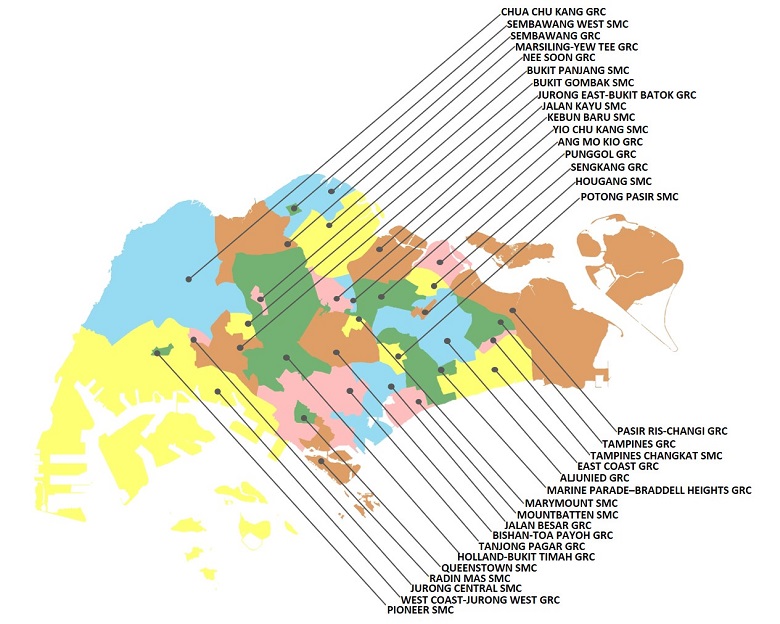
Elections in Singapore are conducted based on electoral divisions.
The boundaries of electoral divisions (i.e. electoral boundaries) are revised regularly to reflect population growth and shifts. The boundaries are recommended by the Electoral Boundaries Review Committee, which is made up of senior civil servants with the relevant domain knowledge. Read the Committee’s latest and past reports here. The gazettes on electoral boundaries can be found here.
You can also view the electoral boundaries on OneMap (by turning on the Hybrid Map function).
Hover the cursor over an electoral division on the map below for the number of electors in that electoral division.
You can also view the electoral boundaries on OneMap (by turning on the Hybrid Map function).
Data as of 1 Feb 2025
Click below to view electoral maps in PDF.